Services
Custom spatial analysis, on demand.
Our data services draw on our expertise and extensive database to answer custom spatial analysis requests.
Three ways our team turns the Curbcut database into answers tailored to your territory.
- 01
Predictive modelling
Predictive modelling and scenario analysis for urban development, socioeconomic and environmental questions.
- 02
Spatial index development
Your technical partner to co-design and develop a spatial index for social equity, urban development, or climate resilience.
- 03
Accessibility analysis
Access to amenities is a key determinant of urban equity, sustainability, and justice. Beyond our platforms’ built-in accessibility features, we provide custom analyses.
Service 01
Predictive modelling
Predictive modelling and scenario analysis for urban development, socioeconomic and environmental questions.
Our approach
We develop customized, high-performance predictive modelling pipelines which combine the billions of data points in the Curbcut database with machine-learning techniques. This lets us extract the maximum signal from messy and complex real-world situations, and to model “what if” scenarios. Our machine-learning approach allows us to model uncertainty, which means that Curbcut predictive models provide not just a best guess about future trajectories, but allow users to know how confident they can be in those trajectories.
Examples of questions we answer
- How much housing is going to be built in the next ten years?
- What effect will new transit development have on housing affordability?
- How will peak electricity demand change in response to electrical vehicle adoption?
Highlighted projectHousing, Infrastructure and Communities Canada
NASH+ housing models
Housing, Infrastructure and Communities Canada mandated Curbcut to develop a modelling and data integration tool to simulate and predict housing and urban development scenarios across Canada.

Service 02
Spatial index development
Your technical partner to co-design and develop a spatial index for social equity, urban development, or climate resilience.
Our approach
Each place is unique. We take a collaborative and iterative approach, working with relevant stakeholders and future index users to ensure the result is fit-for-purpose.
Our process
- 01
Discovery
Stakeholder engagement, context-setting, and definition of objectives and key dimensions.
- 02
Design & development
Data acquisition and processing, index methodology, and first iteration.
- 03
User testing
Validating the index against real-world use cases with relevant stakeholders.
- 04
Refinement
Adjusting methodology and outputs based on structured user feedback.
- 05
Train the trainer
Building internal capacity so the index can be effectively deployed and used by your organization.
Highlighted projectPRDS de Laval
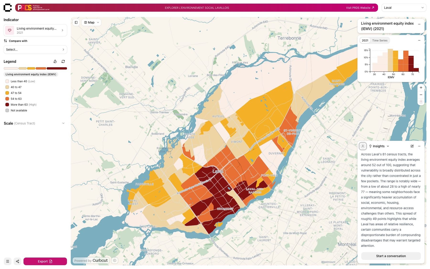
Living-environment equity index
Curbcut developed a multidimensional territorial equity index for the PRDS de Laval, producing a rigorous, transparent, and actionable measure of vulnerability across the territory, refined iteratively with municipal teams to support evidence-based decision-making in urban planning and public policy.
Service 03
Accessibility analysis
Access to amenities is a key determinant of urban equity, sustainability, and justice. Beyond our platforms’ built-in accessibility features, we provide custom analyses.
Our approach
Combining our national travel time matrix with your unique points of interest, we produce custom accessibility analyses for any territory. Define your parameters (mode of transport, distances, destination types, and unit of measure: total population, percentage, or disaggregated by demographic), and we handle the rest.
Examples of questions we answer
- What percentage of the population can reach a library within a 15-minute walk?
- Which neighbourhoods have a high proportion of elderly residents, are vulnerable to heat islands, and lack access to cooling centres by public transit within 10 minutes?
- What proportion of a given demographic group (children, elderly, low-income household) can access essential services in a given timeframe, for example a primary school by foot, or a CLSC by public transit?
How we built it13 Feb 2026
How We Built a Canada-Wide Accessibility and Travel-Time Engine
How Curbcut built reusable, national-scale travel-time infrastructure, and why it matters for equitable, data-driven decision-making across Canada.