Spatial insight platforms
Our platforms give governments, research groups, and civil society instant access to the spatial insights they need, no GIS expertise required.
Three ways to put accessible spatial insight to work, for your organization, your city, and your open-data mission.
Curbcut Studio
A collaborative platform for planning teams to access, explore, analyze and communicate spatial insights, no GIS expertise needed.
- Create, save, collaborate and share spatial insight projects at various scales
- Access hundreds of built-in indicators and use-case-driven templates
- Integrate and cross-reference your own data with Curbcut's extensive database
- Easy visualizations, comparisons, analysis tools, and report generation
Curbcut Cities
For cities looking to provide a unified view of their city, improve access to local insights, and enhance transparency.
- Provide a unified view of your city
- An open-access urban data exploration platform
- Equitable, instant access to quality spatial insights
- Strengthens transparency, trust, and data-driven decisions
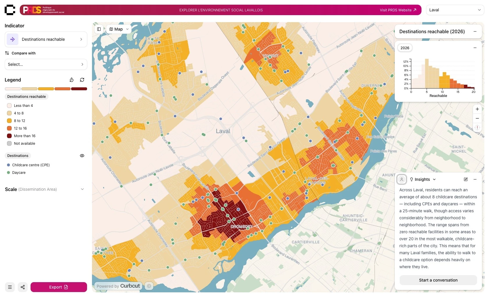
Featured deployment: Curbcut Laval
Curbcut Observatory
For governments and researchers looking to fulfill their open-data ambitions: making spatial data not just publicly available, but genuinely accessible and explorable by everyone.
- A unified view of a domain — housing, mobility, climate — an open-data portal, or your research
- A branded, open-access data exploration platform deployed by Curbcut
- Equitable, instant access to quality spatial insights
- Strengthens transparency, education, and data-driven decisions
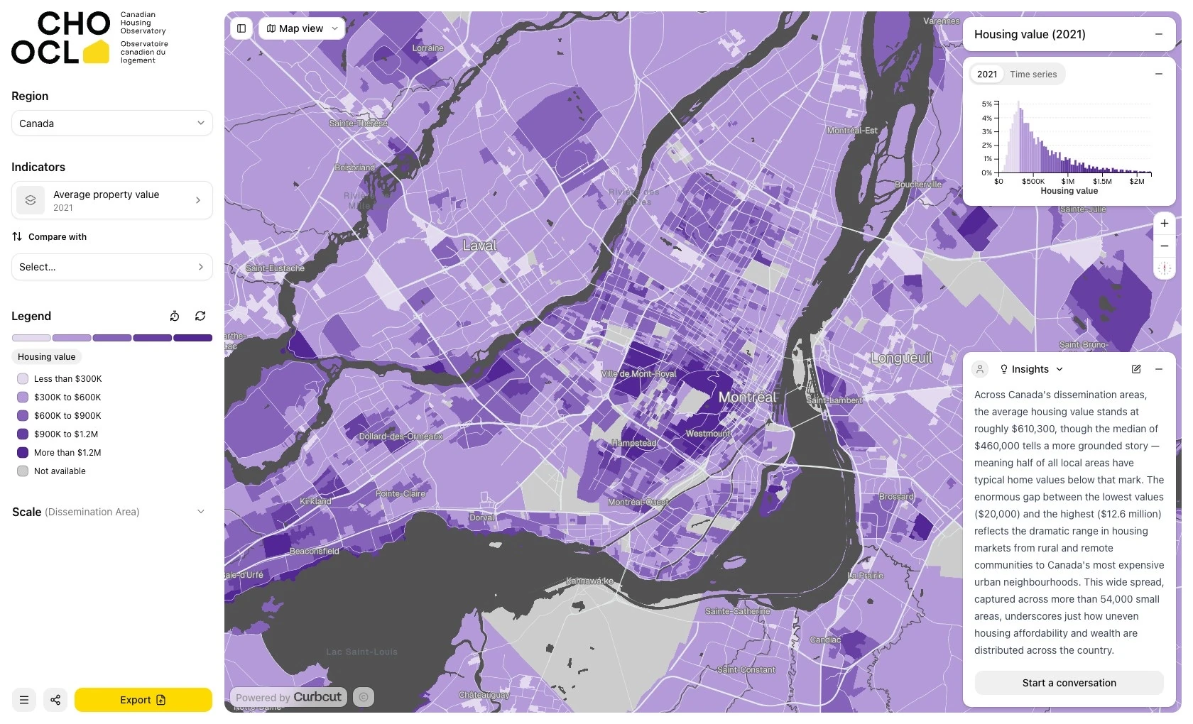
Featured deployment: Canadian Housing Observatory
No GIS expertise required.
See how Curbcut puts the spatial insights you need within instant reach of your whole team.